
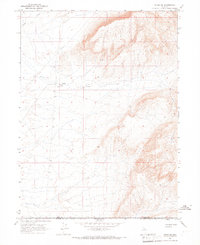
1965 Map of Izzenhood Gap
USGS Topo · Published 1967About this map
Izzenhood Gap serves as a prominent landform in this high-desert portion of Lander County, as recorded by the Geological Survey during the mid-1960s. The landscape is primarily defined by its drainage and water resources, with Sixmile Creek cutting through the northern reaches of the quadrangle. Human activity in this arid environment is sparsely represented but critically placed, centered around the Izzenhood Well and its associated benchmarks. The presence of a Gravel Pit near the gap indicates local industrial use of the geological materials found in these mountains. This survey captures the region just as photogrammetric methods from 1963 aerial photography were being integrated into standard topographic mapping, providing a precise look at the unimproved roads and light-duty trails that crisscrossed the desert floor.
Find a feature on this map
4 named features on this map. Tap any name to fly to it.
Don’t see what you’re looking for? This feature index may not catch every label — zoom into the map to look around manually.
Map Details
Editions of this 1965 Izzenhood Gap Map
This is the sole edition of this map. No revisions or reprints were ever made.
Other maps of this area

1955 · McDermitt
USGS Topo · 1:250,000

1955 · Winnemucca
USGS Topo · 1:250,000

1958 · Winnemucca
USGS Topo · 1:250,000

1959 · McDermitt
USGS Topo · 1:250,000

1962 · Winnemucca
USGS Topo · 1:250,000

1965 · Russells
USGS Topo · 1:24,000

1965 · Sixmile Hill
USGS Topo · 1:24,000

1965 · Sheep Creek Range SW
USGS Topo · 1:24,000

1965 · Sheep Creek Range NW
USGS Topo · 1:24,000
1965 · Midas SW
USGS Topo · 1:24,000