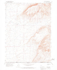
1965 Map of Midas SW
USGS Topo · Published 1967About this map
Evans Creek flows through this high-elevation landscape in northern Nevada, where the desert terrain is defined by its scarce water sources and cattle-working infrastructure. Sparse but critical features like a Well, a lone Spring, and a cluster of Springs illustrate the essential survival needs of this mid-1960s rangeland. The presence of the Guard Corral suggests the area was utilized for livestock management, likely as a seasonal station for ranchers operating across the border between Elko County and Lander County. The terrain is characterized by a high basin floor that rises abruptly into steep, north-trending ridges, capturing a moment when this remote section of the Great Basin remained largely undeveloped except for the most fundamental improvements needed for open-range grazing.
Find a feature on this map
6 named features on this map. Tap any name to fly to it.
Don’t see what you’re looking for? This feature index may not catch every label — zoom into the map to look around manually.
Map Details
Editions of this 1965 Midas SW Map
This is the sole edition of this map. No revisions or reprints were ever made.
Other maps of this area

1882 · Paradise
USGS Topo · 1:250,000

1893 · Paradise
USGS Topo · 1:250,000

1932 · Sonoma Range
USGS Topo · 1:250,000

1939 · Sonoma Range
USGS Topo · 1:250,000

1955 · McDermitt
USGS Topo · 1:250,000

1955 · Winnemucca
USGS Topo · 1:250,000

1958 · Winnemucca
USGS Topo · 1:250,000

1959 · McDermitt
USGS Topo · 1:250,000

1962 · Winnemucca
USGS Topo · 1:250,000
1965 · Izzenhood Gap
USGS Topo · 1:24,000