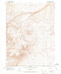
1965 Map of Sixmile Hill
USGS Topo · Published 1967About this map
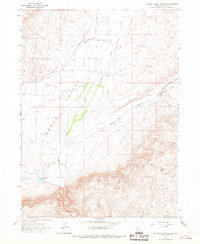
Sixmile Hill dominates the southern landscape of this mid-1960s survey, marking a prominent high point along the border of Elko and Lander counties. The terrain transitions from these elevated peaks down into the broad expanse of Squaw Valley to the north, defined by a complex network of drainage systems. Several vital spring locations are noted across the slopes, indicating the critical nature of water sources in this arid Nevada interior. The presence of Sixmile Creek and various unimproved trails suggests a landscape primarily used for rangeland or mineral exploration during this era. This topographic record provides a clear view of the high-desert geography before significant modern infrastructure, showing the natural contours of landmarks like Squaw and the drainage patterns that feed into the valley floor.
Find a feature on this map
7 named features on this map. Tap any name to fly to it.
Don’t see what you’re looking for? This feature index may not catch every label — zoom into the map to look around manually.
Map Details
Editions of this 1965 Sixmile Hill Map
This is the sole edition of this map. No revisions or reprints were ever made.
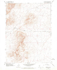
Other maps of this area

1955 · McDermitt
USGS Topo · 1:250,000

1955 · Winnemucca
USGS Topo · 1:250,000

1958 · Winnemucca
USGS Topo · 1:250,000

1959 · McDermitt
USGS Topo · 1:250,000

1962 · Winnemucca
USGS Topo · 1:250,000
1965 · Izzenhood Gap
USGS Topo · 1:24,000
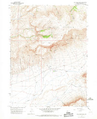
1965 · Jake Creek Mtn
USGS Topo · 1:24,000
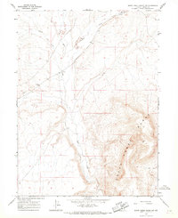
1965 · Sheep Creek Range NW
USGS Topo · 1:24,000
1965 · Squaw Valley Ranch
USGS Topo · 1:24,000
1965 · Midas SW
USGS Topo · 1:24,000