
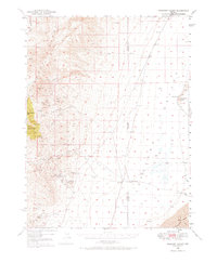
1949 Map of Crescent Valley
USGS Topo · Published 1958About this map
The Shoshone Range and Cortez Mtns dominate this mid-century Nevada landscape, defined by a legacy of mineral extraction and ranching. Activity centers on the Gold Acres Mine and the settlement of Gold Acres at the southern edge of the quadrangle, while several inactive sites like the Goldquartz Mine (Inactive) and Tomcat Mine (Inactive) reflect the shifting fortunes of the district. The transition from high-elevation peaks such as Granite Mtn and Bullion Mtn down into the flat expanse of Crescent Valley is sharp, marked by seasonal water sources like Indian Creek and Fire Creek.
Find a feature on this map
44 named features on this map. Tap any name to fly to it.
Don’t see what you’re looking for? This feature index may not catch every label — zoom into the map to look around manually.
Map Details
Editions of this 1949 Crescent Valley Map
2 editions found
Other maps of this area

1938 · Cortez
USGS Topo · 1:48,000

1944 · Cortez
USGS Topo · 1:62,500

1949 · Mt. Lewis
USGS Topo · 1:62,500

1950 · Mt. Lewis
USGS Topo · 1:62,500

1950 · Crescent Valley
USGS Topo · 1:62,500

1955 · Winnemucca
USGS Topo · 1:250,000

1957 · Frenchie Creek
USGS Topo · 1:62,500

1957 · Dunphy
USGS Topo · 1:62,500

1957 · Beowawe
USGS Topo · 1:62,500

1957 · Horse Creek Valley
USGS Topo · 1:62,500