
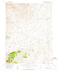
1957 Map of Horse Creek Valley
USGS Topo · Published 1958About this map
The Cortez and Simpson Park Mts rise over this mid-century landscape, framing a region defined by high-desert ranching and mineral exploration. Working life is anchored at the Allison Ranch in the west and Knight Ranch in the northeast, connected by a network of jeep trails and the primary Cortez-Beowawe Road. The map documents a classic Great Basin environment where water sources like Potato Patch Spring and Lower Cottonwood Spr were essential for livestock and the small-scale mining operations scattered through the canyons.
Find a feature on this map
54 named features on this map. Tap any name to fly to it.
Don’t see what you’re looking for? This feature index may not catch every label — zoom into the map to look around manually.
Map Details
Editions of this 1957 Horse Creek Valley Map
2 editions found
Other maps of this area

1926 · Roberts Mountains
USGS Topo · 1:250,000

1929 · Roberts Mountains
USGS Topo · 1:250,000

1937 · Mineral Hill
USGS Topo · 1:48,000

1938 · Cortez
USGS Topo · 1:48,000

1943 · Mineral Hill
USGS Topo · 1:62,500

1944 · Cortez
USGS Topo · 1:62,500

1949 · Garden Valley
USGS Topo · 1:62,500

1949 · Crescent Valley
USGS Topo · 1:62,500

1949 · Roberts Creek Mtn
USGS Topo · 1:62,500

1950 · Crescent Valley
USGS Topo · 1:62,500