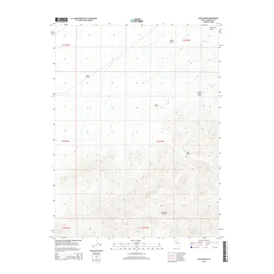
2014 Map of Cow Canyon
USGS Topo · Published 2014About this map
The Clan Alpine Mountains dominate the southern portion of this Churchill County landscape, characterized by complex drainage patterns and steep elevation changes. This 2014 survey captures a section of the Great Basin where narrow corridors like Deep Canyon and Cow Canyon cut through the high desert terrain. To the northwest, the land descends into the floor of Dixie Valley, a notable geographic sink where seasonal runoff from Willow Cr and drainage from Granite Canyon terminates. The map provides a clear look at the Public Land Survey System (PLSS) grid, documenting the boundaries of several townships including t21n r36e and t22n r36e. This transition from high peaks to valley floor illustrates the classic basin and range topography typical of central Nevada.
Find a feature on this map
14 named features on this map. Tap any name to fly to it.
Don’t see what you’re looking for? This feature index may not catch every label — zoom into the map to look around manually.
Map Details
Editions of this 2014 Cow Canyon Map
This is the sole edition of this map. No revisions or reprints were ever made.
Other maps of this area

1908 · Carson Sink
USGS Topo · 1:250,000

1910 · Carson Sink
USGS Topo · 1:250,000

1955 · Millett
USGS Topo · 1:250,000

1957 · Reno
USGS Topo · 1:250,000

1959 · Reno
USGS Topo · 1:250,000

1959 · Millett
USGS Topo · 1:250,000

1960 · Reno
USGS Topo · 1:250,000

1966 · Clan Alpine Ranch
USGS Topo · 1:62,500

1966 · Humboldt Salt Marsh
USGS Topo · 1:62,500

1966 · Dixie Hot Springs
USGS Topo · 1:62,500