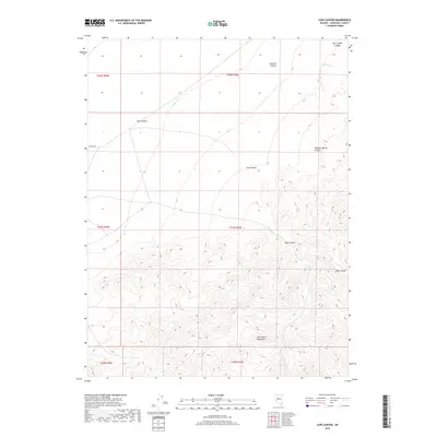
2018 Map of Cow Canyon
USGS Topo · Published 2018About this map
Dixie Valley marks the transition between the arid basin floors and the high, broken terrain of the Clan Alpine Mountains in this 2018 survey. The landscape is defined by a series of significant drainage systems, including Cow Canyon, Deep Canyon, and Meadow Spring Canyon, which carve through the high elevations of the eastern part of the sheet. The rugged topography is captured through 40-foot contour intervals, illustrating the steep ascent from the valley floor toward the eastern peaks and ridges.
Find a feature on this map
15 named features on this map. Tap any name to fly to it.
Don’t see what you’re looking for? This feature index may not catch every label — zoom into the map to look around manually.
Map Details
Editions of this 2018 Cow Canyon Map
This is the sole edition of this map. No revisions or reprints were ever made.
Other maps of this area

1908 · Carson Sink
USGS Topo · 1:250,000

1910 · Carson Sink
USGS Topo · 1:250,000

1955 · Millett
USGS Topo · 1:250,000

1957 · Reno
USGS Topo · 1:250,000

1959 · Reno
USGS Topo · 1:250,000

1959 · Millett
USGS Topo · 1:250,000

1960 · Reno
USGS Topo · 1:250,000

1966 · Clan Alpine Ranch
USGS Topo · 1:62,500

1966 · Humboldt Salt Marsh
USGS Topo · 1:62,500

1966 · Dixie Hot Springs
USGS Topo · 1:62,500