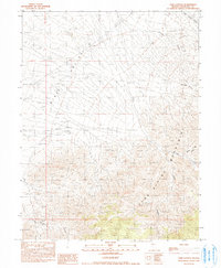
1990 Map of Cow Canyon
USGS Topo · Published 1990About this map
Dixie Valley and the Clan Alpine Mountains define this arid landscape in Churchill County, Nevada. The terrain transitions sharply from the wide floor of the valley to the high, deeply incised slopes of the mountain range. This 1990 provisional survey records a series of prominent drainage features, including the eponymous Cow Canyon and Deer Lodge Canyon to the north. Sparse water sources like Grover Point Well and Meadow Spring Can reflect the desert environment and the vital importance of scattered springs and wells for livestock or travel. Several named canyons, such as Sheep Trough Canyon and Granite Canyon, suggest a history of localized use, where specific ravines provided passage or shelter in the high country.
Find a feature on this map
11 named features on this map. Tap any name to fly to it.
Don’t see what you’re looking for? This feature index may not catch every label — zoom into the map to look around manually.
Map Details
Editions of this 1990 Cow Canyon Map
This is the sole edition of this map. No revisions or reprints were ever made.
Other maps of this area

1908 · Carson Sink
USGS Topo · 1:250,000

1910 · Carson Sink
USGS Topo · 1:250,000

1955 · Millett
USGS Topo · 1:250,000

1957 · Reno
USGS Topo · 1:250,000

1959 · Reno
USGS Topo · 1:250,000

1959 · Millett
USGS Topo · 1:250,000

1960 · Reno
USGS Topo · 1:250,000

1966 · Clan Alpine Ranch
USGS Topo · 1:62,500

1966 · Humboldt Salt Marsh
USGS Topo · 1:62,500

1966 · Dixie Hot Springs
USGS Topo · 1:62,500