
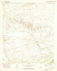
1973 Map of Cow Mountain
USGS Topo · Published 1976About this map
The Delaware River cuts through the northern reaches of this West Texas landscape, providing a vital water source in an otherwise arid expanse of Culberson County. Water management is a central theme of this 1970s topography, evidenced by the presence of numerous collection points like Middle Tank, White Tank, and Tank No 12. These features, along with named locations such as Walker Wells, illustrate the essential infrastructure required for ranching and resource management in this corner of the Trans-Pecos region.
Find a feature on this map
14 named features on this map. Tap any name to fly to it.
Don’t see what you’re looking for? This feature index may not catch every label — zoom into the map to look around manually.
Map Details
Editions of this 1973 Cow Mountain Map
This is the sole edition of this map. No revisions or reprints were ever made.
Other maps of this area

1954 · Van Horn
USGS Topo · 1:250,000

1958 · Van Horn
USGS Topo · 1:250,000

1973 · Seven L Peak
USGS Topo · 1:24,000

1973 · Chico Draw East
USGS Topo · 1:24,000

1973 · Delaware Spring
USGS Topo · 1:24,000
1973 · Long Point
USGS Topo · 1:24,000
1973 · Chico Draw West
USGS Topo · 1:24,000
1973 · Independence Spring
USGS Topo · 1:24,000
1973 · South Rector Canyon
USGS Topo · 1:24,000
1973 · Alligator Draw
USGS Topo · 1:24,000