
1973 Map of Seven L Peak
USGS Topo · Published 1975About this map
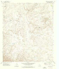
Seven L Peak and the surrounding high desert of Culberson County are captured here in the early 1970s, revealing a landscape defined by the search for water. The terrain is marked by an extensive network of ephemeral drainages, such as Wild Horse Draw, Virginia Draw, and Castile Draw, which carve through the arid plains. Ranching infrastructure is central to this map, with numerous isolated water sources like Seven L Well, High Lonesome Well, and Cave Well serving as vital hubs in the wide-open range.
Find a feature on this map
16 named features on this map. Tap any name to fly to it.
Don’t see what you’re looking for? This feature index may not catch every label — zoom into the map to look around manually.
Map Details
Editions of this 1973 Seven L Peak Map
This is the sole edition of this map. No revisions or reprints were ever made.
Other maps of this area

1954 · Van Horn
USGS Topo · 1:250,000

1958 · Van Horn
USGS Topo · 1:250,000

1973 · Two Mill Draw West
USGS Topo · 1:24,000

1973 · Seven L Peak NE
USGS Topo · 1:24,000

1973 · K C Ranch
USGS Topo · 1:24,000

1973 · Chico Draw East
USGS Topo · 1:24,000

1973 · Cow Mountain
USGS Topo · 1:24,000

1973 · Delaware Spring
USGS Topo · 1:24,000
1973 · Emory Corral
USGS Topo · 1:24,000
1973 · Castile Hill
USGS Topo · 1:24,000