
1973 Map of Two Mill Draw West
USGS Topo · Published 1976About this map
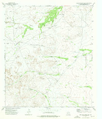
Old Christian Place and the scattered settlement at Walker anchor this high-desert landscape in west Texas during the early 1970s. The terrain is defined by a complex network of ephemeral drainage systems, where life centered on precious water sources like Canyon Spring and the mechanical reliability of West Windmill. The map reveals a land utilized for ranching, evidenced by the presence of Old Grapevine Well along Two Mill Draw and the distinctively named Budweiser Draw to the southwest. While modern infrastructure is sparse, the intricate contouring illustrates the deep cuts made by Big Canyon Draw and Cottonwood Creek, showing how the geography dictated the placement of early homesteads and livestock operations in this corner of Culberson County.
Find a feature on this map
11 named features on this map. Tap any name to fly to it.
Don’t see what you’re looking for? This feature index may not catch every label — zoom into the map to look around manually.
Map Details
Editions of this 1973 Two Mill Draw West Map
This is the sole edition of this map. No revisions or reprints were ever made.
Other maps of this area

1928 · Kent
USGS Topo · 1:125,000

1954 · Van Horn
USGS Topo · 1:250,000

1958 · Van Horn
USGS Topo · 1:250,000

1973 · Dellahunt Draw West
USGS Topo · 1:24,000

1973 · Seven L Peak
USGS Topo · 1:24,000

1973 · Seven L Peak NE
USGS Topo · 1:24,000

1973 · Rustler Hills
USGS Topo · 1:24,000

1973 · K C Ranch
USGS Topo · 1:24,000
1973 · Dellahunt Draw East
USGS Topo · 1:24,000
1973 · Two Mill Draw East
USGS Topo · 1:24,000