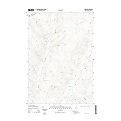
2015 Map of Cowen Hill
USGS Topo · Published 2015About this map
Indian Stream and Perry Stream carve deep, parallel north-south drainages through this northernmost reach of the New Hampshire woods, just south of the international border with Canada. The landscape is defined by its watershed network, where high points like Covell Mtn and Cowen Hill separate numerous tributaries, including the cascading waters of Roaring Brook and Trestle Brook. Evidence of managed water resources and access is visible in the W Br Indian Stream Reservoir and the remote Klondike Camp Trl. This area, historically known for its isolation and independent spirit, is depicted here as a dense forest interior punctuated by clearings like Lamb Valley and isolated water bodies such as Terrell Pond and Round Pond. Small logging or access roads like Perley Rd and Indian Stream Rd provide the only terrestrial links through the timbered slopes.
Find a feature on this map
41 named features on this map. Tap any name to fly to it.
Don’t see what you’re looking for? This feature index may not catch every label — zoom into the map to look around manually.
Map Details
Editions of this 2015 Cowen Hill Map
This is the sole edition of this map. No revisions or reprints were ever made.
Other maps of this area

1925 · Indian Stream
USGS Topo · 1:48,000

1926 · Indian Stream
USGS Topo · 1:62,500

1927 · Indian Stream
USGS Topo · 1:62,500

1927 · Moose Bog
USGS Topo · 1:48,000

1927 · Second Lake
USGS Topo · 1:62,500

1931 · Moose Bog
USGS Topo · 1:62,500

1932 · Second Lake
USGS Topo · 1:62,500

1949 · Jackman
USGS Topo · 1:250,000

1963 · Jackman
USGS Topo · 1:250,000

1966 · Sherbrooke
USGS Topo · 1:250,000