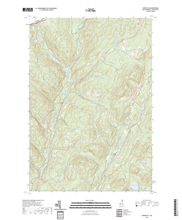
2024 Map of Cowen Hill
USGS Topo · Published 2024About this map
Indian Stream and its numerous tributaries dominate this northern reaches of New Hampshire, where the landscape is defined by the convergence of the West Branch, Middle Branch, and East Branch. The drainage patterns here are intricate, with small waters like Cascade Brook and Jabbers Brook feeding the main stems within the deep folds of Lamb Valley. This is a terrain of high ridges and isolated peaks, including the prominent Cowen Hill and Covell Mtn, which rise above the surrounding wetlands and ponds such as Terrell Pond and the expansive Coon Brook Bog.
Find a feature on this map
42 named features on this map. Tap any name to fly to it.
Don’t see what you’re looking for? This feature index may not catch every label — zoom into the map to look around manually.
Map Details
Editions of this 2024 Cowen Hill Map
This is the sole edition of this map. No revisions or reprints were ever made.
Other maps of this area

1925 · Indian Stream
USGS Topo · 1:48,000

1926 · Indian Stream
USGS Topo · 1:62,500

1927 · Indian Stream
USGS Topo · 1:62,500

1927 · Moose Bog
USGS Topo · 1:48,000

1927 · Second Lake
USGS Topo · 1:62,500

1931 · Moose Bog
USGS Topo · 1:62,500

1932 · Second Lake
USGS Topo · 1:62,500

1949 · Jackman
USGS Topo · 1:250,000

1963 · Jackman
USGS Topo · 1:250,000

1966 · Sherbrooke
USGS Topo · 1:250,000