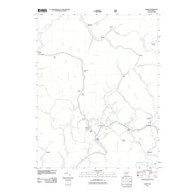
2011 Map of Cowen
USGS Topo · Published 2011About this map
Cowen serves as the central hub of this West Virginia landscape, where the confluence of numerous creeks and runs dictated the early development of Webster County. The settlement pattern follows the drainages of the Birch River and Laurel Creek, with smaller communities like Welch Glade, Glade View, and Upperglade establishing significant footprints along the valley floors. For genealogists and local historians, the map is a detailed record of family names and rural infrastructure, identifying several burial sites including the McElwain Cemetery, Hoover Cemetery, and Handschumacher Cemetery. The terrain is marked by distinct geographic hollows such as Coal Hollow and Deep Hollow, reflecting the region's industrial ties. Water management is a notable feature of the 21st-century landscape, specifically the Big Ditch Run Structure One Dam located just north of the town center, which shapes the local hydrology alongside natural landmarks like the Otter Hole on the Birch River.
Find a feature on this map
85 named features on this map. Tap any name to fly to it.
Don’t see what you’re looking for? This feature index may not catch every label — zoom into the map to look around manually.
Map Details
Editions of this 2011 Cowen Map
This is the sole edition of this map. No revisions or reprints were ever made.
Other maps of this area

1889 · Nicholas
USGS Topo · 1:125,000

1891 · Nicholas
USGS Topo · 1:125,000

1891 · Huntersville
USGS Topo · 1:125,000

1893 · Buckhannon
USGS Topo · 1:125,000

1893 · Sutton
USGS Topo · 1:125,000

1894 · Huntersville
USGS Topo · 1:125,000

1896 · Buckhannon
USGS Topo · 1:125,000

1897 · Buckhannon
USGS Topo · 1:125,000

1901 · Nicholas
USGS Topo · 1:125,000

1908 · Sutton
USGS Topo · 1:48,000