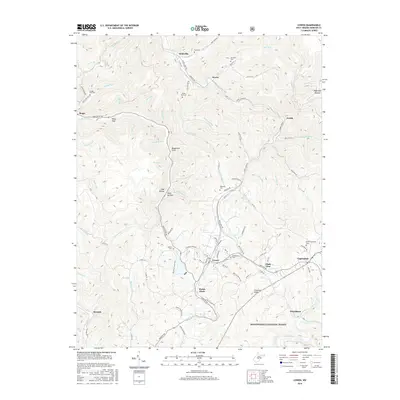
2016 Map of Cowen
USGS Topo · Published 2016About this map
Cowen serves as the central hub of this Webster County landscape, where the confluence of local roads and family-named landmarks defines the rural West Virginia interior. The terrain is deeply carved by the Birch River and the Gauley River, with numerous hollows and drafts such as Baughman Draft, Coal Hollow, and Deep Hollow indicating the region's historic coal and timber associations. Small settlements and former post office sites like Wainville, Boggs, and Welch Glade are connected by a network of rural routes including Erbacon Rd and Webster Rd. Local genealogy is well-preserved through numerous hillside burials, including the Oddfellows Cem and Handschumacher Cem. The southern reach of the map transitions into the protected landscape of the Monongahela National Forest, illustrating the balance between established homesteads and the vast timbered ridges of the Allegheny plateau.
Find a feature on this map
101 named features on this map. Tap any name to fly to it.
Don’t see what you’re looking for? This feature index may not catch every label — zoom into the map to look around manually.
Map Details
Editions of this 2016 Cowen Map
This is the sole edition of this map. No revisions or reprints were ever made.
Other maps of this area

1889 · Nicholas
USGS Topo · 1:125,000

1891 · Nicholas
USGS Topo · 1:125,000

1891 · Huntersville
USGS Topo · 1:125,000

1893 · Buckhannon
USGS Topo · 1:125,000

1893 · Sutton
USGS Topo · 1:125,000

1894 · Huntersville
USGS Topo · 1:125,000

1896 · Buckhannon
USGS Topo · 1:125,000

1897 · Buckhannon
USGS Topo · 1:125,000

1901 · Nicholas
USGS Topo · 1:125,000

1908 · Sutton
USGS Topo · 1:48,000