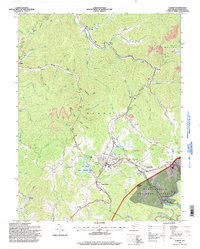
1995 Map of Cowen
USGS Topo · Published 1998About this map
Cowen serves as the primary hub of this Webster County landscape, where the CSX Transportation railroad line winds through the valleys alongside Laurel Creek. The region is defined by its numerous glades and watercourses, including the notable engineering of the Long Glade Ditch and the Big Ditch public fishing area. This mid-1990s record shows a landscape shaped by both nature and industry, with extensive Strip Mines appearing throughout the northern and eastern quadrants, particularly near Halo and Arcola.
Find a feature on this map
77 named features on this map. Tap any name to fly to it.
Don’t see what you’re looking for? This feature index may not catch every label — zoom into the map to look around manually.
Map Details
Editions of this 1995 Cowen Map
This is the sole edition of this map. No revisions or reprints were ever made.
Other maps of this area

1889 · Nicholas
USGS Topo · 1:125,000

1891 · Nicholas
USGS Topo · 1:125,000

1891 · Huntersville
USGS Topo · 1:125,000

1893 · Buckhannon
USGS Topo · 1:125,000

1893 · Sutton
USGS Topo · 1:125,000

1894 · Huntersville
USGS Topo · 1:125,000

1896 · Buckhannon
USGS Topo · 1:125,000

1897 · Buckhannon
USGS Topo · 1:125,000

1901 · Nicholas
USGS Topo · 1:125,000

1908 · Sutton
USGS Topo · 1:48,000