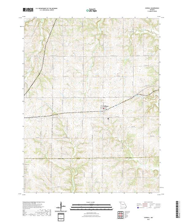
2021 Map of Cowgill
USGS Topo · Published 2021About this map
Cowgill serves as the central hub of this Missouri landscape, where local infrastructure is deeply intertwined with the drainage of the E Fork Crooked River and its numerous tributaries. The geography is defined by a network of creeks including Log Creek, Brush Creek, and Crabapple Creek, which feed into several small reservoirs such as Creason Lake and Mann Lake. Local history and genealogy are preserved in the Cowgill Cemetery just south of town and the McVeigh Cemetery near the western edge. The township is characterized by a dense grid of rural routes and secondary roads, reflecting a long-standing agricultural pattern. This 2021 survey shows how modern naming conventions like SE Rock Island Road and SE Soo Line Drive preserve the memory of former rail corridors that once linked this part of Caldwell and Ray Counties to the wider region.
Find a feature on this map
62 named features on this map. Tap any name to fly to it.
Don’t see what you’re looking for? This feature index may not catch every label — zoom into the map to look around manually.
Map Details
Editions of this 2021 Cowgill Map
This is the sole edition of this map. No revisions or reprints were ever made.
Other maps of this area

1889 · Lexington
USGS Topo · 1:125,000

1894 · Independence
USGS Topo · 1:125,000

1924 · Polo
USGS Topo · 1:62,500

1924 · Braymer
USGS Topo · 1:62,500

1950 · Kansas City
USGS Topo · 1:250,000

1953 · Moberly
USGS Topo · 1:250,000

1954 · Kansas City
USGS Topo · 1:250,000

1954 · Moberly
USGS Topo · 1:250,000

1956 · Kansas City
USGS Topo · 1:250,000

1957 · Moberly
USGS Topo · 1:250,000