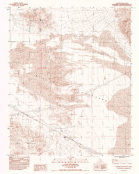
1983 Map of Cowhole Mountain
USGS Topo · Published 1985About this map
Sands sits as a quiet rail point along the Union Pacific tracks in the early 1980s, marking a transition between the elevated topography of the Bristol Mountains and the shifting terrain of the Mojave. This landscape is defined by the extensive Sand Dunes of the Devils Playground, which stretch across the central portion of the sheet toward the foot of Cowhole Mountain.
Find a feature on this map
9 named features on this map. Tap any name to fly to it.
Don’t see what you’re looking for? This feature index may not catch every label — zoom into the map to look around manually.
Map Details
Editions of this 1983 Cowhole Mountain Map
2 editions found
Other maps of this area

1910 · Ivanpah
USGS Topo · 1:250,000

1912 · Ivanpah
USGS Topo · 1:250,000

1933 · Avawatz Mountains
USGS Topo · 1:250,000

1942 · Ivanpah
USGS Topo · 1:250,000

1942 · Amboy
USGS Topo · 1:250,000

1943 · Amboy
USGS Topo · 1:250,000

1947 · Trona
USGS Topo · 1:250,000

1947 · Kingman
USGS Topo · 1:250,000

1948 · Kingman
USGS Topo · 1:250,000

1948 · Trona
USGS Topo · 1:250,000