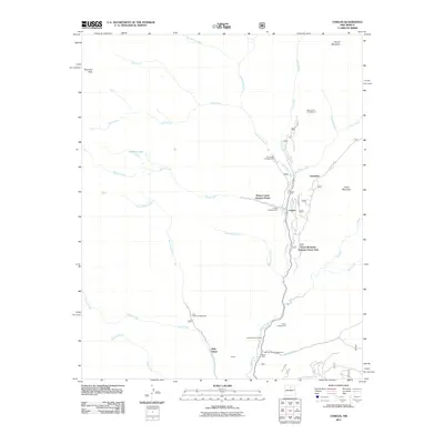
2011 Map of Cowles
USGS Topo · Published 2011About this map
The Pecos River valley defines the character of this northern New Mexico landscape, serving as a corridor for settlement and recreation near Cowles. This 2011 survey shows the area's transition from extractive industry to seasonal residences, notably the Pecos Mine and the nearby Pecos Mine Cemetery located south of the main settlement. Further north, the river is joined by Jacks Creek and Panchuela Creek, creating a network of high-elevation drainages that support a variety of Forest Service sites like Jacks Creek Campground and Panchuela Campground.
Find a feature on this map
48 named features on this map. Tap any name to fly to it.
Don’t see what you’re looking for? This feature index may not catch every label — zoom into the map to look around manually.
Map Details
Editions of this 2011 Cowles Map
This is the sole edition of this map. No revisions or reprints were ever made.
Other maps of this area

1889 · Santa Fe
USGS Topo · 1:125,000

1894 · Santa Fe
USGS Topo · 1:125,000

1953 · Sierra Mosca
USGS Topo · 1:24,000

1953 · Mc Clure Reservoir
USGS Topo · 1:24,000

1953 · Aspen Basin
USGS Topo · 1:24,000

1954 · Santa Fe
USGS Topo · 1:250,000

1958 · Santa Fe
USGS Topo · 1:250,000

1961 · Honey Boy Ranch
USGS Topo · 1:24,000

1961 · Rosilla Peak
USGS Topo · 1:24,000
1961 · Cowles
USGS Topo · 1:24,000