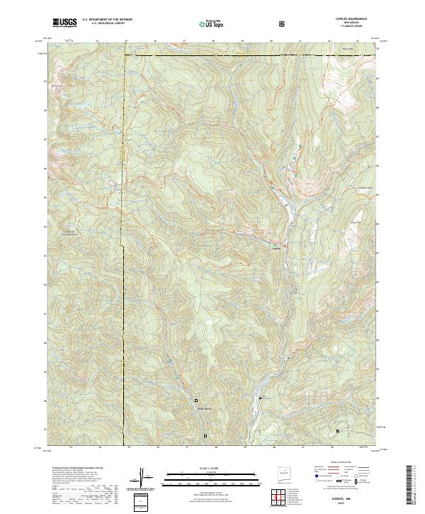
2023 Map of Cowles
USGS Topo · Published 2023About this map
Pecos River headwaters dominate this high-altitude landscape within the Santa Fe National Forest and Pecos Wilderness. The settlement of Cowles serves as a central point for a dense network of mountain trails, including the Winsor Ridge Trl and Jacks Creek Trl, which connect high-alpine features like Lake Johnson, Lake Katherine, and Spirit Lake. The presence of the Pecos Mine Cem south of Holy Ghost indicates the area's history of mineral extraction, contrasting with the preservation focus of the Pecos Wild and Scenic River corridor. The geography is defined by significant elevations such as Redondo Peak and Grass Mtn, with numerous drainages like Panchuela Creek and Carpenter Creek feeding into the main river system. This terrain shows the modern intersection of recreational trail development and historical industrial markers in the Sangre de Cristo Mountains.
Find a feature on this map
51 named features on this map. Tap any name to fly to it.
Don’t see what you’re looking for? This feature index may not catch every label — zoom into the map to look around manually.
Map Details
Editions of this 2023 Cowles Map
This is the sole edition of this map. No revisions or reprints were ever made.
Other maps of this area

1889 · Santa Fe
USGS Topo · 1:125,000

1894 · Santa Fe
USGS Topo · 1:125,000

1953 · Sierra Mosca
USGS Topo · 1:24,000

1953 · Mc Clure Reservoir
USGS Topo · 1:24,000

1953 · Aspen Basin
USGS Topo · 1:24,000

1954 · Santa Fe
USGS Topo · 1:250,000

1958 · Santa Fe
USGS Topo · 1:250,000

1961 · Honey Boy Ranch
USGS Topo · 1:24,000

1961 · Rosilla Peak
USGS Topo · 1:24,000
1961 · Cowles
USGS Topo · 1:24,000