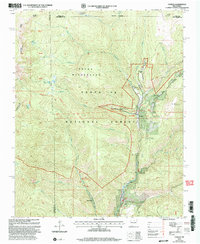
2002 Map of Cowles
USGS Topo · Published 2003About this map
The Pecos River valley defines the character of this high-altitude landscape within the Santa Fe National Forest at the start of the 21st century. Settlement is concentrated along the river corridor, particularly at Cowles and the nearby Geronimo, while specialized recreational and seasonal residential patterns are evident at the Winsor Creek Summer Home Area and Grass Mountain Summer Home Area. The map documents a transition between active forest recreation and industrial history, notably at the Tererro Mine near the southern edge, where Mine Dumps sit near the confluence of Willow Creek. High alpine features such as Lake Johnson and Stewart Lake are reachable only by foot via the National Recreation Trail, highlighting the protected nature of the Pecos Wilderness area which covers much of the northwestern terrain.
Find a feature on this map
42 named features on this map. Tap any name to fly to it.
Don’t see what you’re looking for? This feature index may not catch every label — zoom into the map to look around manually.
Map Details
Editions of this 2002 Cowles Map
This is the sole edition of this map. No revisions or reprints were ever made.
Other maps of this area

1889 · Santa Fe
USGS Topo · 1:125,000

1894 · Santa Fe
USGS Topo · 1:125,000

1953 · Sierra Mosca
USGS Topo · 1:24,000

1953 · Mc Clure Reservoir
USGS Topo · 1:24,000

1953 · Aspen Basin
USGS Topo · 1:24,000

1954 · Santa Fe
USGS Topo · 1:250,000

1958 · Santa Fe
USGS Topo · 1:250,000

1961 · Honey Boy Ranch
USGS Topo · 1:24,000

1961 · Rosilla Peak
USGS Topo · 1:24,000
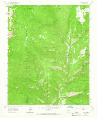
1961 · Cowles
USGS Topo · 1:24,000