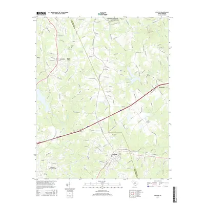
2017 Map of Cowpens
USGS Topo · Published 2017About this map
Cowpens National Battlefield occupies the northern border of this landscape, marking the site of a pivotal American Revolutionary War engagement where the Spartanburg and Cherokee county lines meet. To the south, the terrain descends toward the Pacolet River, which forms a winding southern boundary. The local economy and settlement patterns are anchored by Mayo Mills and the town of Cowpens, with several small communities such as Enola and Macedonia scattered across the Piedmont uplands.
Find a feature on this map
163 named features on this map. Tap any name to fly to it.
Don’t see what you’re looking for? This feature index may not catch every label — zoom into the map to look around manually.
Map Details
Editions of this 2017 Cowpens Map
This is the sole edition of this map. No revisions or reprints were ever made.
Other maps of this area

1909 · Gaffney
USGS Topo · 1:62,500

1941 · Spartanburg
USGS Topo · 1:250,000

1947 · Spartanburg
USGS Topo · 1:62,500

1949 · Spartanburg
USGS Topo · 1:24,000

1949 · Spartanburg
USGS Topo · 1:62,500

1953 · Spartanburg
USGS Topo · 1:250,000

1953 · Charlotte
USGS Topo · 1:250,000

1954 · Charlotte
USGS Topo · 1:250,000

1959 · Cowpens
USGS Topo · 1:62,500

1960 · Charlotte
USGS Topo · 1:250,000