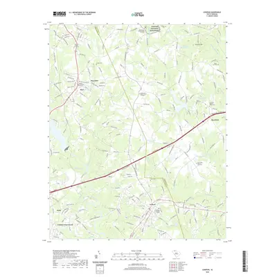
2020 Map of Cowpens
USGS Topo · Published 2020About this map
Cowpens National Battlefield stands as a focal point in this portion of the South Carolina Upcountry, marking the site of a pivotal American Revolution engagement along the border of Spartanburg Co and Cherokee Co. The landscape is defined by the headwaters of Thicketty Creek and the Pacolet River, which once powered the textile operations at Mayo Mills. A dense network of rural roads, such as Battleground Rd and Old Metal Rd, connects established communities like Cowpens and Macedonia.
Find a feature on this map
210 named features on this map. Tap any name to fly to it.
Don’t see what you’re looking for? This feature index may not catch every label — zoom into the map to look around manually.
Map Details
Editions of this 2020 Cowpens Map
This is the sole edition of this map. No revisions or reprints were ever made.
Other maps of this area

1909 · Gaffney
USGS Topo · 1:62,500

1941 · Spartanburg
USGS Topo · 1:250,000

1947 · Spartanburg
USGS Topo · 1:62,500

1949 · Spartanburg
USGS Topo · 1:24,000

1949 · Spartanburg
USGS Topo · 1:62,500

1953 · Spartanburg
USGS Topo · 1:250,000

1953 · Charlotte
USGS Topo · 1:250,000

1954 · Charlotte
USGS Topo · 1:250,000

1959 · Cowpens
USGS Topo · 1:62,500

1960 · Charlotte
USGS Topo · 1:250,000