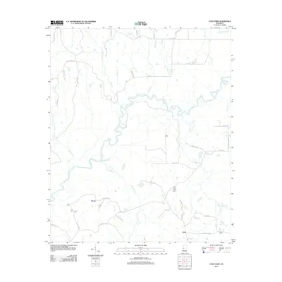
2012 Map of Coxs Ferry
USGS Topo · Published 2012About this map
The Big Black River snakes through this Hinds County landscape, defining the character of a region where water and history are deeply intertwined. Near the river's edge, the small settlement of Coxs Ferry marks an old crossing point, accompanied by the Cox Cem and Dawson Cem. The survey reveals a network of rural roads such as Cox Ferry Rd and Johnson Line Rd that connect small communities and family landmarks. To the east, the settlement of Adelle and the Good Hope Baptist Church serve as local anchors. Numerous tributaries, including Bogue Chitto Cr and the descriptively named Turkeyfoot Br, drain into the main river channel. This 2012 documentation provides a clear look at the persistent agricultural and residential patterns of this riverine territory, preserving the locations of several smaller burial grounds like Hinter Cem and Clayton Cem.
Find a feature on this map
56 named features on this map. Tap any name to fly to it.
Don’t see what you’re looking for? This feature index may not catch every label — zoom into the map to look around manually.
Map Details
Editions of this 2012 Coxs Ferry Map
This is the sole edition of this map. No revisions or reprints were ever made.
Other maps of this area

1903 · Jackson
USGS Topo · 1:125,000

1934 · Raymond
USGS Topo · 1:48,000

1937 · Raymond
USGS Topo · 1:62,500

1938 · Edwards
USGS Topo · 1:62,500

1940 · Mechanicsburg
USGS Topo · 1:62,500

1942 · Raymond
USGS Topo · 1:62,500

1955 · Jackson
USGS Topo · 1:250,000

1961 · Jackson
USGS Topo · 1:250,000

1962 · Jackson
USGS Topo · 1:250,000

1962 · Flora
USGS Topo · 1:62,500