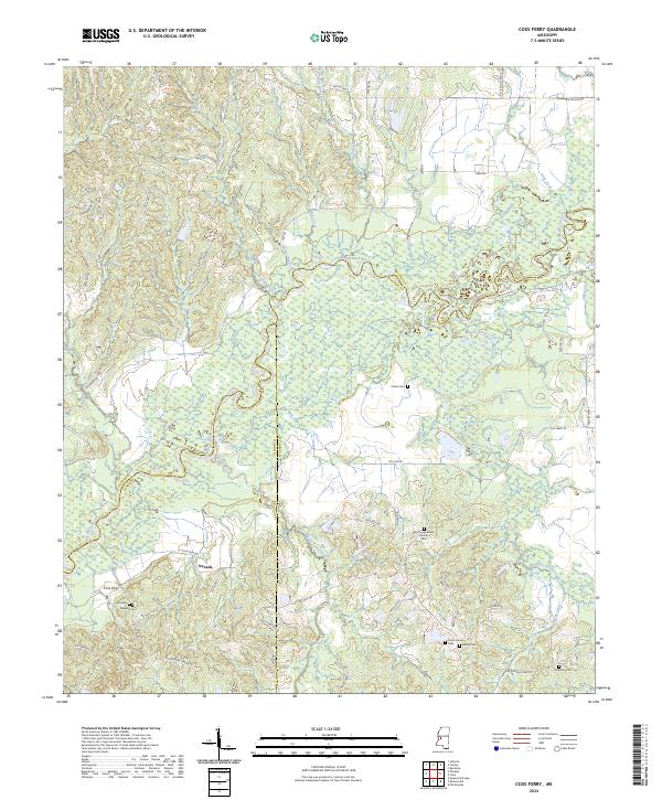
2024 Map of Coxs Ferry
USGS Topo · Published 2024About this map
The Big Black River meanders through the heart of this landscape, marking the historical boundaries between Yazoo, Hinds, and Madison Counties. This river-fed terrain is defined by its complex drainage network, where Bogue Chitto Creek, Turkeyfoot Branch, and Bessie Roe Branch feed into the primary waterway. The small settlement of Nevada serves as a central landmark amidst a region largely shaped by the winding Cox Ferry Rd, which traces the high ground above the bottomlands. Genealogists will find significant value in the numerous burial sites dispersed throughout the area, including the Smith Family Cem, Bethel Cem, and the Good Hope Baptist Church Cem. These scattered cemeteries and the Good Hope Baptist Church reflect the enduring rural community structure of central Mississippi in the early 21st century.
Find a feature on this map
57 named features on this map. Tap any name to fly to it.
Don’t see what you’re looking for? This feature index may not catch every label — zoom into the map to look around manually.
Map Details
Editions of this 2024 Coxs Ferry Map
This is the sole edition of this map. No revisions or reprints were ever made.
Other maps of this area

1903 · Jackson
USGS Topo · 1:125,000

1934 · Raymond
USGS Topo · 1:48,000

1937 · Raymond
USGS Topo · 1:62,500

1938 · Edwards
USGS Topo · 1:62,500

1940 · Mechanicsburg
USGS Topo · 1:62,500

1942 · Raymond
USGS Topo · 1:62,500

1955 · Jackson
USGS Topo · 1:250,000

1961 · Jackson
USGS Topo · 1:250,000

1962 · Jackson
USGS Topo · 1:250,000

1962 · Flora
USGS Topo · 1:62,500