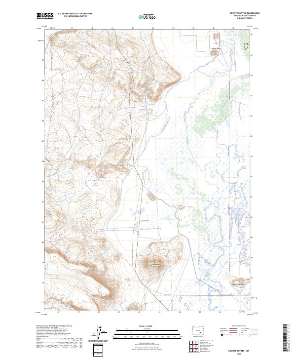
2023 Map of Coyote Buttes
USGS Topo · Published 2023About this map
The Malheur National Wildlife Refuge dominates the eastern half of this landscape, where the waters of the Donner und Blitzen River weave through a network of wetlands and channels. The hydrological complexity of the area is defined by the Simmons Slough, Stubblefield Canal, and Butte Ditch, reflecting long-standing efforts to manage water within the high desert environment of Harney County. West of the Blitzen Valley, the terrain rises toward Coyote Flat and several prominent volcanic landmarks.
Find a feature on this map
20 named features on this map. Tap any name to fly to it.
Don’t see what you’re looking for? This feature index may not catch every label — zoom into the map to look around manually.
Map Details
Editions of this 2023 Coyote Buttes Map
This is the sole edition of this map. No revisions or reprints were ever made.
Other maps of this area

1955 · Burns
USGS Topo · 1:250,000

1958 · Burns
USGS Topo · 1:250,000

1959 · Burns
USGS Topo · 1:250,000

1959 · Dog Mountain
USGS Topo · 1:62,500

1959 · Lawen
USGS Topo · 1:62,500

1967 · Coyote Buttes
USGS Topo · 1:24,000

1967 · Jackass Butte
USGS Topo · 1:24,000

1967 · Jackass Butte NE
USGS Topo · 1:24,000
1967 · Diamond Swamp
USGS Topo · 1:24,000

1978 · Malheur Lake
USGS Topo · 1:100,000