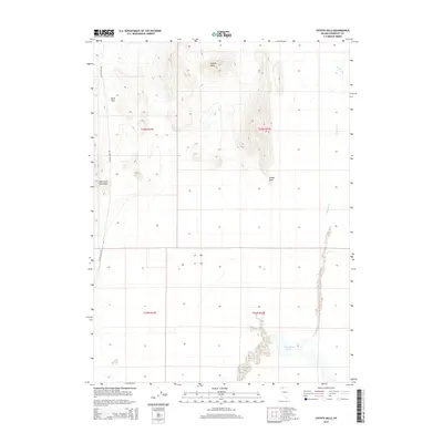
2015 Map of Coyote Hills
USGS Topo · Published 2015About this map
The Quinn River Lakes form a distinct hydrological feature in the southern portion of this high-desert basin in Humboldt County, Nevada. This 2015 survey captures a stark landscape defined by the drainage patterns of the Kings River to the east and the rugged elevations of the Coyote Hills and Bilk Creek Mountains to the west. The presence of Sand Pass and Coyote Point suggests a terrain shaped by ancient lake beds and wind-blown deposits, characteristic of the Great Basin's topography. Human presence is limited to the corridor of Coyote Point Rd, reflecting the remote and preserved nature of this region. The map provides a detailed view of the township and range divisions, including t43n r34e, which are essential for property and resource management in this arid expanse.
Find a feature on this map
11 named features on this map. Tap any name to fly to it.
Don’t see what you’re looking for? This feature index may not catch every label — zoom into the map to look around manually.
Map Details
Editions of this 2015 Coyote Hills Map
This is the sole edition of this map. No revisions or reprints were ever made.
Other maps of this area

1886 · Disaster
USGS Topo · 1:250,000

1893 · Disaster
USGS Topo · 1:250,000

1954 · Vya
USGS Topo · 1:250,000

1958 · Vya
USGS Topo · 1:250,000

1961 · Quinn River Crossing
USGS Topo · 1:62,500

1961 · Thacker Pass
USGS Topo · 1:62,500

1961 · Bottle Creek
USGS Topo · 1:62,500

1962 · Vya
USGS Topo · 1:250,000

1979 · Denio
USGS Topo · 1:100,000
1982 · Bottle Creek Slough NW
USGS Topo · 1:24,000