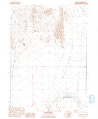
1991 Map of Coyote Hills
USGS Topo · Published 1991About this map
The Kings River Valley serves as a stark topographical divide between the high desert peaks and the expansive river basins of northern Nevada. This 1991 provisional survey captures the intersection of the Quinn River and the Kings River, where the waters flow toward the ephemeral Quinn Lakes. The rugged landscape is dominated by the Coyote Hills, featuring prominent landmarks such as Coyote Point and the gap at Sand Pass. Human impact on the land is recorded through several Prospects and a Prospect located in the higher elevations, indicating the area's history of mineral exploration. A portion of the Fort Mc Dermitt Indian Reservation occupies the southern reach of the quadrangle, where the river system begins its seasonal spread across the arid basin floor near a significant Dry Lake.
Find a feature on this map
13 named features on this map. Tap any name to fly to it.
Don’t see what you’re looking for? This feature index may not catch every label — zoom into the map to look around manually.
Map Details
Editions of this 1991 Coyote Hills Map
This is the sole edition of this map. No revisions or reprints were ever made.
Other maps of this area

1886 · Disaster
USGS Topo · 1:250,000

1893 · Disaster
USGS Topo · 1:250,000

1954 · Vya
USGS Topo · 1:250,000

1958 · Vya
USGS Topo · 1:250,000

1961 · Quinn River Crossing
USGS Topo · 1:62,500

1961 · Thacker Pass
USGS Topo · 1:62,500

1961 · Bottle Creek
USGS Topo · 1:62,500

1962 · Vya
USGS Topo · 1:250,000

1979 · Denio
USGS Topo · 1:100,000
1982 · Bottle Creek Slough NW
USGS Topo · 1:24,000