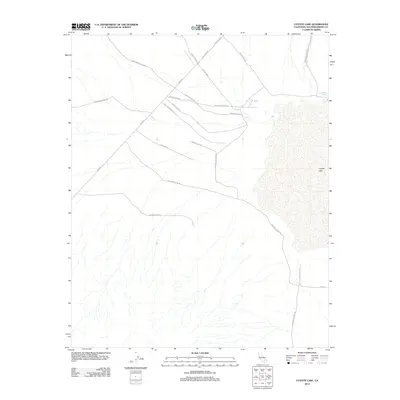
2012 Map of Coyote Lake
USGS Topo · Published 2012About this map
Coyote Lake dominates the eastern portion of this high desert landscape, characterized by the intricate drainage patterns of alluvial fans that feed into the dry lake bed. The road network reflects a history of desert habitation and mining exploration, with routes like Olympus Mine Rd and Starbright Mine Rd suggesting the local mineral pursuits common to this part of San Bernardino County. Ranching history is also evident in the named tracks such as Shenks Ranch Rd, Lazy Too Ranch Rd, and Rocking K Ranch Rd. In the north, Fort Irwin Rd and Camp Irwin Rd mark the proximity to military operations, while the remote Jack Rabbit Spring provides a rare point of named hydrology in an otherwise arid environment.
Find a feature on this map
18 named features on this map. Tap any name to fly to it.
Don’t see what you’re looking for? This feature index may not catch every label — zoom into the map to look around manually.
Map Details
Editions of this 2012 Coyote Lake Map
This is the sole edition of this map. No revisions or reprints were ever made.
Other maps of this area

1933 · Avawatz Mountains
USGS Topo · 1:250,000

1947 · Trona
USGS Topo · 1:250,000

1948 · Trona
USGS Topo · 1:250,000

1948 · Alvord Mountain
USGS Topo · 1:62,500

1948 · Lane Mountain
USGS Topo · 1:62,500

1951 · Alvord Mountain
USGS Topo · 1:62,500

1951 · Lane Mountain
USGS Topo · 1:62,500

1953 · San Bernardino
USGS Topo · 1:250,000

1953 · Yermo
USGS Topo · 1:24,000

1953 · Trona
USGS Topo · 1:250,000