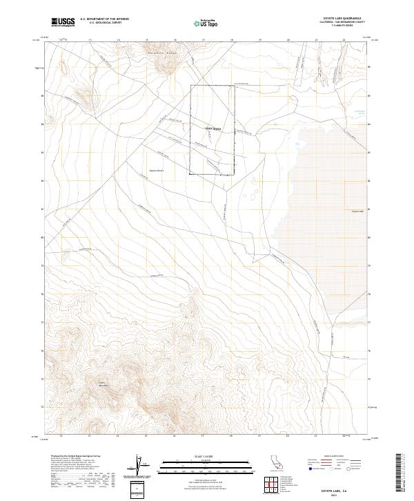
2021 Map of Coyote Lake
USGS Topo · Published 2021About this map
The Mojave Desert floor dominates this landscape, punctuated by the high elevations of the Paradise Range to the north and the Calico Mountains in the southwest corner. Transportation in this arid region is defined by a network of specialized routes, including Starbright Mine Rd and Mother Lode Rd, indicating a history of mineral extraction and prospecting. The eastern edge of the survey contains a portion of the Coyote Lake dry bed, a distinctive alkaline flat. Scattered water sources like Jack Rabbit Spring and landmarks such as the Rocking K Ranch Rd suggest the sparse but persistent human footprint in this part of San Bernardino County. The land is largely divided by section lines under the Public Land Survey System, as seen in the designations for t12n r1e and t11n r2e.
Find a feature on this map
24 named features on this map. Tap any name to fly to it.
Don’t see what you’re looking for? This feature index may not catch every label — zoom into the map to look around manually.
Map Details
Editions of this 2021 Coyote Lake Map
This is the sole edition of this map. No revisions or reprints were ever made.
Other maps of this area

1933 · Avawatz Mountains
USGS Topo · 1:250,000

1947 · Trona
USGS Topo · 1:250,000

1948 · Trona
USGS Topo · 1:250,000

1948 · Alvord Mountain
USGS Topo · 1:62,500

1948 · Lane Mountain
USGS Topo · 1:62,500

1951 · Alvord Mountain
USGS Topo · 1:62,500

1951 · Lane Mountain
USGS Topo · 1:62,500

1953 · San Bernardino
USGS Topo · 1:250,000

1953 · Yermo
USGS Topo · 1:24,000

1953 · Trona
USGS Topo · 1:250,000