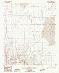
1986 Map of Coyote Lake
USGS Topo · Published 1986About this map
Coyote Lake dominates the eastern portion of this desert landscape, its vast dry bed set against the high elevations of the Paradise Range and the Calico Mountains. The mid-1980s topography reveals a region defined by water scarcity and military presence, with the Fort Irwin Military Reservation boundary bisecting the central terrain. Evidence of the search for resources is scattered throughout the arid hills, appearing as numerous prospects and a Gravel Pit.
Find a feature on this map
12 named features on this map. Tap any name to fly to it.
Don’t see what you’re looking for? This feature index may not catch every label — zoom into the map to look around manually.
Map Details
Editions of this 1986 Coyote Lake Map
This is the sole edition of this map. No revisions or reprints were ever made.
Other maps of this area

1933 · Avawatz Mountains
USGS Topo · 1:250,000

1947 · Trona
USGS Topo · 1:250,000

1948 · Trona
USGS Topo · 1:250,000

1948 · Alvord Mountain
USGS Topo · 1:62,500

1948 · Lane Mountain
USGS Topo · 1:62,500

1951 · Alvord Mountain
USGS Topo · 1:62,500

1951 · Lane Mountain
USGS Topo · 1:62,500

1953 · San Bernardino
USGS Topo · 1:250,000

1953 · Yermo
USGS Topo · 1:24,000

1953 · Trona
USGS Topo · 1:250,000