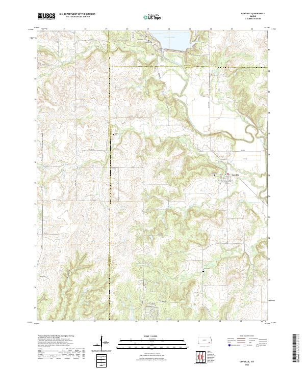
2022 Map of Coyville
USGS Topo · Published 2022About this map
Coyville sits near the confluence of the Verdigris River and Brush Cr in this rural landscape at the intersection of Wilson, Woodson, and Greenwood counties. The terrain is defined by a series of drainage systems, including Greathouse Cr, Silver Cr, and Ross Br, which carve through the plains. To the north, the waters of Toronto Lake and Woodson Cove highlight the area's modern hydraulic management. Genealogy researchers will find several well-preserved landmarks of the early community, such as the Coyville Cem, Carlisle Cem, and the remote Hunter Cem located near the southern boundary. The local road network, including Coyville Rd and Old Sand Rd, follows the section lines of the Public Land Survey System, reflecting the organized agricultural settlement of the Kansas prairie. These established boundaries and watercourses provide a clear picture of the land's transition from open range to a structured network of farms and small town life.
Find a feature on this map
62 named features on this map. Tap any name to fly to it.
Don’t see what you’re looking for? This feature index may not catch every label — zoom into the map to look around manually.
Map Details
Editions of this 2022 Coyville Map
This is the sole edition of this map. No revisions or reprints were ever made.
Other maps of this area

1885 · Eureka
USGS Topo · 1:125,000

1886 · Fredonia
USGS Topo · 1:125,000

1888 · Eureka
USGS Topo · 1:125,000

1894 · Fredonia
USGS Topo · 1:125,000

1894 · Eureka
USGS Topo · 1:125,000

1938 · Fredonia
USGS Topo · 1:62,500

1939 · Fredonia
USGS Topo · 1:48,000

1939 · Severy
USGS Topo · 1:62,500

1941 · Severy
USGS Topo · 1:62,500

1942 · Fredonia
USGS Topo · 1:62,500