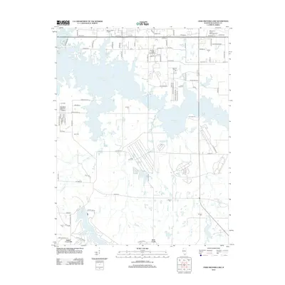
2012 Map of Crab Orchard Lake
USGS Topo · Published 2012About this map
Crab Orchard Lake dominates this Williamson County landscape, its sprawling fingers creating a complex shoreline that includes Propeller Point and numerous small inlets. This early 21st-century record reveals a region where higher education and transport infrastructure meet rural heritage. In the north, John A Logan College and the Williamson County Regional Airport signify modern development, while the southern reaches near Devils Kitchen Lake maintain a more dispersed, creek-cut character.
Find a feature on this map
97 named features on this map. Tap any name to fly to it.
Don’t see what you’re looking for? This feature index may not catch every label — zoom into the map to look around manually.
Map Details
Editions of this 2012 Crab Orchard Lake Map
This is the sole edition of this map. No revisions or reprints were ever made.
Other maps of this area

1909 · West Frankfort
USGS Topo · 1:62,500

1910 · Herrin
USGS Topo · 1:62,500

1922 · Carbondale
USGS Topo · 1:62,500

1925 · Marion
USGS Topo · 1:62,500

1936 · Herrin
USGS Topo · 1:62,500

1940 · Marion
USGS Topo · 1:62,500

1941 · Carbondale
USGS Topo · 1:62,500

1941 · West Frankfort
USGS Topo · 1:62,500

1949 · Paducah
USGS Topo · 1:250,000

1950 · Paducah
USGS Topo · 1:250,000