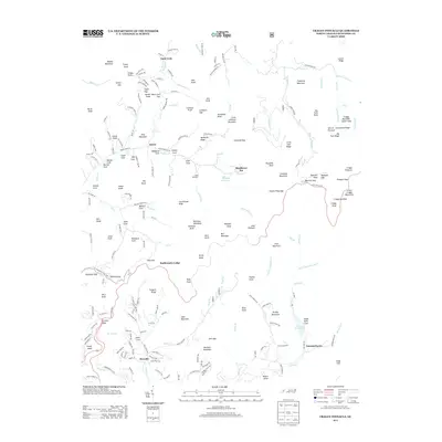
2013 Map of Craggy Pinnacle
USGS Topo · Published 2013About this map
The Blue Ridge Pkwy snakes through the high ridges of Buncombe County, serving as a primary transit vein through a landscape defined by steep gaps and deep coves. Settlement is concentrated in the lower elevations, notably near Riceville and Beech, where local roads trace the paths of Bull Cr and Shope Creek. The water management of the region is evident through the inclusion of the Beetree Reservoir and Woodfin Reservoir, which sit tucked between peaks like Snowball Mountain and Wolfden Knob. For those interested in the recreational and historical footprint of the area, landmarks such as Rattlesnake Lodge and the Blackberry Inn offer specific points of interest. This survey reflects the modern balance of conserved mountain land and the expanding residential reaches found near Summerhaven and Countryside Est.
Find a feature on this map
218 named features on this map. Tap any name to fly to it.
Don’t see what you’re looking for? This feature index may not catch every label — zoom into the map to look around manually.
Map Details
Editions of this 2013 Craggy Pinnacle Map
This is the sole edition of this map. No revisions or reprints were ever made.
Other maps of this area

1894 · Asheville
USGS Topo · 1:125,000

1900 · Mount Mitchell
USGS Topo · 1:125,000

1901 · Asheville
USGS Topo · 1:125,000

1902 · Mount Mitchell
USGS Topo · 1:125,000

1935 · Montreat
USGS Topo · 1:24,000

1935 · Black Brothers
USGS Topo · 1:24,000

1935 · Black Mountain
USGS Topo · 1:24,000

1935 · Barnardsville
USGS Topo · 1:24,000

1935 · Craggy Pinnacle
USGS Topo · 1:24,000

1936 · Weaverville
USGS Topo · 1:24,000