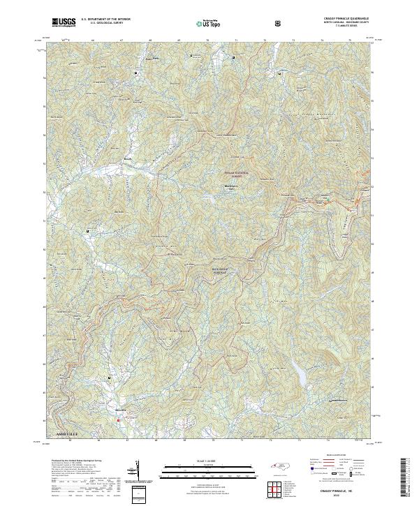
2022 Map of Craggy Pinnacle
USGS Topo · Published 2022About this map
Pisgah National Forest dominates this high-elevation landscape north of Asheville, where the Blue Ridge Parkway winds along the crests of Richland Mountain and Bull Mountain. This modern survey illustrates the rugged interface between public forest lands and small community settlements like Riceville and Paint Fork. Researchers can trace the drainage of Reems Creek and Beetree Creek, which flow from the heights of the Great Craggy Mountains. Significant family landmarks and historical burial sites are noted throughout the terrain, including Jay Allen Cemetery and Ballard Cemetery. The map also highlights recreational and ecological landmarks such as the Mountains-to-Sea Trail and the botanical area of Craggy Gardens, providing a contemporary view of this preserved Appalachian corridor.
Find a feature on this map
183 named features on this map. Tap any name to fly to it.
Don’t see what you’re looking for? This feature index may not catch every label — zoom into the map to look around manually.
Map Details
Editions of this 2022 Craggy Pinnacle Map
This is the sole edition of this map. No revisions or reprints were ever made.
Other maps of this area

1894 · Asheville
USGS Topo · 1:125,000

1900 · Mount Mitchell
USGS Topo · 1:125,000

1901 · Asheville
USGS Topo · 1:125,000

1902 · Mount Mitchell
USGS Topo · 1:125,000

1935 · Montreat
USGS Topo · 1:24,000

1935 · Black Brothers
USGS Topo · 1:24,000

1935 · Black Mountain
USGS Topo · 1:24,000

1935 · Barnardsville
USGS Topo · 1:24,000

1935 · Craggy Pinnacle
USGS Topo · 1:24,000

1936 · Weaverville
USGS Topo · 1:24,000