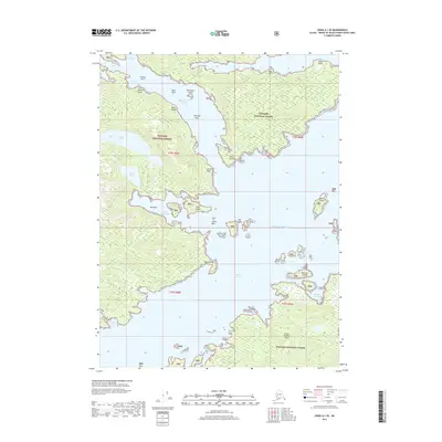
2017 Map of Craig A-1 SE
USGS Topo · Published 2017About this map
Prince of Wales Island and the intricate maritime landscape of Southeast Alaska dominate this 2017 survey, characterized by deep-water inlets and a complex archipelago within the Tongass National Forest. The map centers on the historical activity around Niblack Anchorage and the nearby Niblack Lake, tracing a rugged coastline defined by protected harbors like Cannery Cove and Menefee Anchorage. These names suggest a legacy of maritime industry and refuge along the Moira Sound. Further inland, the hydrology includes Myrtle Lake and Myrtle Cr, while the shoreline is dotted with navigational landmarks such as Point Halliday, Point Jansen, and Crowell Point. The presence of the Egg Islands and Moira Island in the Pacific Ocean waters highlights the fragmented terrain of the Alexander Archipelago, where the connection between land and sea remains the defining geographic feature for those navigating these coastal waters.
Find a feature on this map
35 named features on this map. Tap any name to fly to it.
Don’t see what you’re looking for? This feature index may not catch every label — zoom into the map to look around manually.
Map Details
Editions of this 2017 Craig A-1 SE Map
This is the sole edition of this map. No revisions or reprints were ever made.
Other maps of this area

1948 · Prince Rupert D-6
USGS Topo · 1:63,360

1948 · Ketchikan A-6
USGS Topo · 1:63,360

1948 · Craig A-1
USGS Topo · 1:63,360

1948 · Dixon Entrance D-1
USGS Topo · 1:63,360

1951 · Prince Rupert
USGS Topo · 1:250,000

1951 · Dixon Entrance
USGS Topo · 1:250,000

1951 · Prince Rupert D-6
USGS Topo · 1:63,360

1952 · Ketchikan
USGS Topo · 1:250,000

1955 · Ketchikan
USGS Topo · 1:250,000

1957 · Craig
USGS Topo · 1:250,000