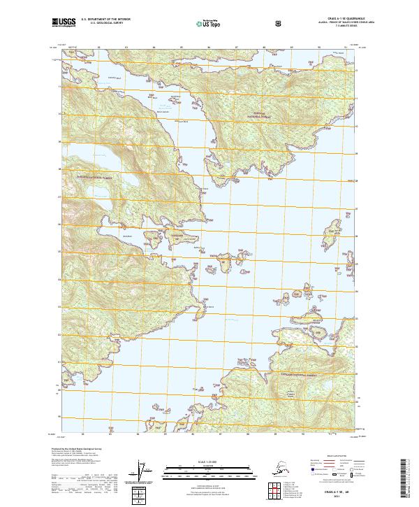
2021 Map of Craig A-1 SE
USGS Topo · Published 2021About this map
Tongass National Forest dominates this coastal landscape on the southeastern reaches of Prince of Wales Island. This 2021 topographic survey captures a labyrinth of inlets and protected waters, most notably within the branching arms of Moira Sound. Several established anchorages, including Niblack Anchorage and Menefee Anchorage, indicate the area's importance for maritime navigation and shelter. Inland, the terrain is defined by substantial freshwater bodies such as Niblack Lake and Myrtle Lake, which sit at the base of significant coastal elevations. Historical sites such as Cannery Cove and Cannery Point suggest a legacy of local industry tied to the region's rich fisheries. The map also identifies numerous maritime hazards and navigational markers, from the clusters of the Egg Islands and Menefee Islands to isolated features like Beck Rock and Almquist Rock, illustrating the complex coastal geography of the Alexander Archipelago.
Find a feature on this map
32 named features on this map. Tap any name to fly to it.
Don’t see what you’re looking for? This feature index may not catch every label — zoom into the map to look around manually.
Map Details
Editions of this 2021 Craig A-1 SE Map
This is the sole edition of this map. No revisions or reprints were ever made.
Other maps of this area

1948 · Prince Rupert D-6
USGS Topo · 1:63,360

1948 · Ketchikan A-6
USGS Topo · 1:63,360

1948 · Craig A-1
USGS Topo · 1:63,360

1948 · Dixon Entrance D-1
USGS Topo · 1:63,360

1951 · Prince Rupert
USGS Topo · 1:250,000

1951 · Dixon Entrance
USGS Topo · 1:250,000

1951 · Prince Rupert D-6
USGS Topo · 1:63,360

1952 · Ketchikan
USGS Topo · 1:250,000

1955 · Ketchikan
USGS Topo · 1:250,000

1957 · Craig
USGS Topo · 1:250,000