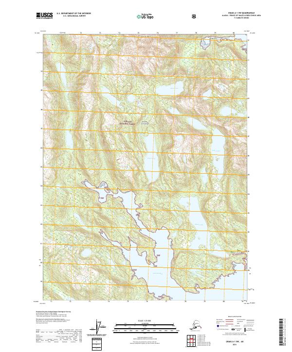
2021 Map of Craig A-1 SW
USGS Topo · Published 2021About this map
Tongass National Forest dominates this coastal landscape in the Alexander Archipelago, where the intricate intersection of land and sea is defined by deep inlets and glacial lakes. The saltwater reaches of Dickman Bay and Aiken Cove provide access to a hinterland of high ridges, crowned by Eudora Mtn. Interior drainage systems are marked by significant bodies of freshwater including Kugel Lake, Kegan Lake, and the high-elevation Aiken Lake. This survey illustrates the primitive character of the region's transportation, relying on natural water passages like Clarence Strait and localized drainages such as Aiken Cr and Kugel Cr. A surveyor's mark at Kegan Lake Tri serves as a fixed point in this vast maritime forest, where topographical relief rises sharply from the shoreline of Lake Luella to the peaks of the interior.
Find a feature on this map
18 named features on this map. Tap any name to fly to it.
Don’t see what you’re looking for? This feature index may not catch every label — zoom into the map to look around manually.
Map Details
Editions of this 2021 Craig A-1 SW Map
This is the sole edition of this map. No revisions or reprints were ever made.
Other maps of this area

1948 · Dixon Entrance D-2
USGS Topo · 1:63,360

1948 · Craig A-1
USGS Topo · 1:63,360

1948 · Dixon Entrance D-1
USGS Topo · 1:63,360

1948 · Craig A-2
USGS Topo · 1:63,360

1951 · Dixon Entrance
USGS Topo · 1:250,000

1951 · Dixon Entrance D-2
USGS Topo · 1:63,360

1951 · Craig A-2
USGS Topo · 1:63,360

1957 · Craig
USGS Topo · 1:250,000

1959 · Dixon Entrance
USGS Topo · 1:250,000
1994 · Dixon Entrance D-1
USGS Topo · 1:63,360