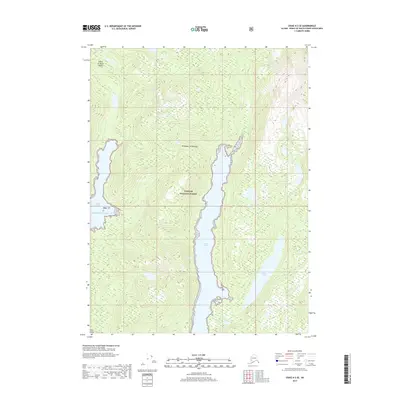
2017 Map of Craig A-2 SE
USGS Topo · Published 2017About this map
Klakas Inlet cuts a deep path through the interior of Prince of Wales Island, anchoring a landscape within the Tongass National Forest. This 2017 survey reflects the enduring wild character of the Alexander Archipelago, where the land is defined by steep contour lines and complex coastal indentations rather than human infrastructure. The map follows the long, narrow corridor of the inlet as it reaches toward the freshwater Klakas Lake in the south, illustrating the intricate drainage patterns of the coastal rainforest. To the west, the headwaters of Keete Inlet mark the transition toward the open Pacific Ocean. This map is particularly valuable for those studying the topography of southeastern Alaska, showing the exact relationship between deep-water fjords and the densely forested ridges that characterize the region.
Find a feature on this map
8 named features on this map. Tap any name to fly to it.
Don’t see what you’re looking for? This feature index may not catch every label — zoom into the map to look around manually.
Map Details
Editions of this 2017 Craig A-2 SE Map
This is the sole edition of this map. No revisions or reprints were ever made.
Other maps of this area

1948 · Dixon Entrance D-2
USGS Topo · 1:63,360

1948 · Craig A-1
USGS Topo · 1:63,360

1948 · Dixon Entrance D-1
USGS Topo · 1:63,360

1948 · Craig A-2
USGS Topo · 1:63,360

1951 · Dixon Entrance
USGS Topo · 1:250,000

1951 · Dixon Entrance D-2
USGS Topo · 1:63,360

1951 · Craig A-2
USGS Topo · 1:63,360

1957 · Craig
USGS Topo · 1:250,000

1959 · Dixon Entrance
USGS Topo · 1:250,000
1994 · Dixon Entrance D-1
USGS Topo · 1:63,360