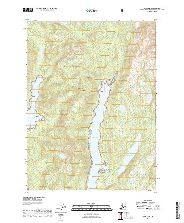
2021 Map of Craig A-2 SE
USGS Topo · Published 2021About this map
Prince of Wales Island provides the setting for this study of Southeast Alaskan wilderness within the Alexander Archipelago. The landscape is dominated by the narrow, fjord-like reach of Klakas Inlet, which carves deeply into the southern portion of the island. Entirely contained within the Tongass National Forest, the map illustrates a terrain of significant elevation changes and dense drainage patterns typical of the region's temperate rainforest environment. Southeast of the primary inlet, Klakas Lake sits tucked between steep ridges, representing one of the few large freshwater bodies in this immediate sector. The map serves as a detailed record of the natural coastline and interior topography before any modern infrastructure or industrial development altered these specific coordinates.
Find a feature on this map
10 named features on this map. Tap any name to fly to it.
Don’t see what you’re looking for? This feature index may not catch every label — zoom into the map to look around manually.
Map Details
Editions of this 2021 Craig A-2 SE Map
This is the sole edition of this map. No revisions or reprints were ever made.
Other maps of this area

1948 · Dixon Entrance D-2
USGS Topo · 1:63,360

1948 · Craig A-1
USGS Topo · 1:63,360

1948 · Dixon Entrance D-1
USGS Topo · 1:63,360

1948 · Craig A-2
USGS Topo · 1:63,360

1951 · Dixon Entrance
USGS Topo · 1:250,000

1951 · Dixon Entrance D-2
USGS Topo · 1:63,360

1951 · Craig A-2
USGS Topo · 1:63,360

1957 · Craig
USGS Topo · 1:250,000

1959 · Dixon Entrance
USGS Topo · 1:250,000
1994 · Dixon Entrance D-1
USGS Topo · 1:63,360