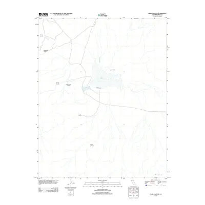
2012 Map of Craig Canyon
USGS Topo · Published 2012About this map
Saline Valley dominates this high-desert landscape in Inyo County, centered on the stark basin of Salt Lake. The map reveals a drainage system defined by seasonal flows, with Waucoba Wash entering from the north and numerous named canyons carving into the surrounding slopes. These geographic features, including Craig Canyon and Daisy Canyon, illustrate the complex alluvial fan system that feeds the valley floor. Transportation is limited to the winding path of Saline Valley Rd, which provides the primary access through this arid environment. The sheer concentration of deep-cut drainages like Keynot Canyon and San Lucas Canyon underscores the topographical isolation of the basin, offering a detailed view of the natural water-collection patterns that define the region's character.
Find a feature on this map
11 named features on this map. Tap any name to fly to it.
Don’t see what you’re looking for? This feature index may not catch every label — zoom into the map to look around manually.
Map Details
Editions of this 2012 Craig Canyon Map
This is the sole edition of this map. No revisions or reprints were ever made.
Other maps of this area

1908 · Ballarat
USGS Topo · 1:250,000

1913 · Ballarat
USGS Topo · 1:250,000

1948 · Death Valley
USGS Topo · 1:250,000

1950 · New York Butte
USGS Topo · 1:62,500

1950 · Ubehebe Peak
USGS Topo · 1:62,500

1951 · New York Butte
USGS Topo · 1:62,500

1951 · Ubehebe Peak
USGS Topo · 1:62,500

1951 · Waucoba Wash
USGS Topo · 1:62,500

1954 · Death Valley
USGS Topo · 1:250,000

1956 · Death Valley
USGS Topo · 1:250,000