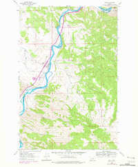
1961 Map of Craig
USGS Topo · Published 1979About this map
The Missouri River defines this portion of the Montana landscape, carving a deep path through the canyon between Brewer Hill and the surrounding high country. The small settlement of Craig sits along the western bank, serving as a focal point for the region's transportation network where the Burlington Northern railroad tracks parallel the water. Engineering feats of the era are visible in the form of Tunnel No 3, which carries the rails through the steep river bluffs.
Find a feature on this map
23 named features on this map. Tap any name to fly to it.
Don’t see what you’re looking for? This feature index may not catch every label — zoom into the map to look around manually.
Map Details
Editions of this 1961 Craig Map
3 editions found

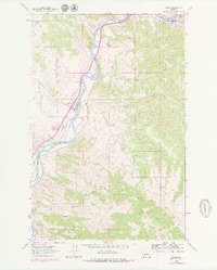
Other maps of this area

1886 · Great Falls
USGS Topo · 1:250,000

1886 · Fort Logan
USGS Topo · 1:250,000

1889 · Helena
USGS Topo · 1:250,000

1893 · Helena
USGS Topo · 1:250,000

1899 · Helena
USGS Topo · 1:250,000

1903 · Helena
USGS Topo · 1:250,000

1943 · Hogan
USGS Topo · 1:125,000

1947 · Butte
USGS Topo · 1:250,000

1948 · White Sulphur Springs
USGS Topo · 1:250,000

1954 · Great Falls
USGS Topo · 1:250,000