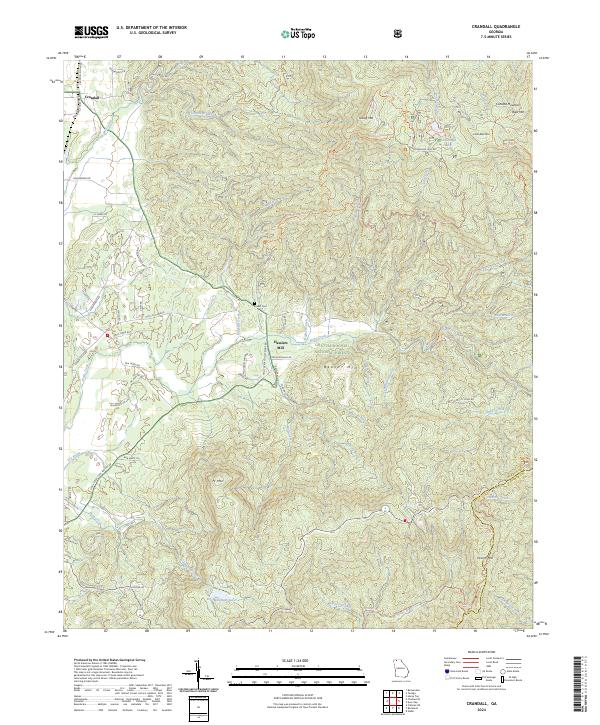
2024 Map of Crandall
USGS Topo · Published 2024About this map
Crandall and the neighboring community of Hasslers Mill are situated at the threshold of the Chattahoochee National Forest in this modern survey of Murray and Gilmer counties. The landscape is defined by the steep elevation changes of the Blue Ridge, featuring prominent peaks like Ft Mtn, Beaver Mtn, and Grassy Mtn. Water systems are integral to the area's geography, with Holly Creek and its many tributaries, such as Emery Branch and Milma Branch, cutting through the timbered slopes. Notable human landmarks include the Ernest Cem and Mountain View Ch, while the CSX Transportation line runs north-south near the western edge. Further east, the Cohutta Wilderness begins near Conasauga Lake, where the terrain rises toward Bald Mtn. The road network, including the Crandall Ellijay Rd and Fort Mt Park Rd, reflects the area's role as a gateway for mountain recreation and regional transit.
Find a feature on this map
77 named features on this map. Tap any name to fly to it.
Don’t see what you’re looking for? This feature index may not catch every label — zoom into the map to look around manually.
Map Details
Editions of this 2024 Crandall Map
This is the sole edition of this map. No revisions or reprints were ever made.
Other maps of this area

1886 · Dalton
USGS Topo · 1:125,000

1892 · Dalton
USGS Topo · 1:125,000

1897 · Dalton
USGS Topo · 1:125,000

1911 · Cohutta Mtn
USGS Topo · 1:62,500

1913 · Cohutta Mtn.
USGS Topo · 1:62,500

1914 · Talking Rock
USGS Topo · 1:62,500

1916 · Talking Rock
USGS Topo · 1:62,500
1935 · Hemp Top
USGS Topo · 1:24,000

1938 · Chatsworth
USGS Topo · 1:48,000

1943 · Dalton
USGS Topo · 1:62,500