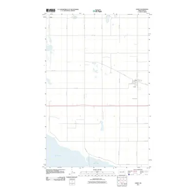
2011 Map of Crary
USGS Topo · Published 2011About this map
Crary serves as the primary settlement on this North Dakota prairie landscape, located at the intersection of local routes like Dakota Ave and Main St. To the south, the expansive waters of Devils Lake and East Devils Lake dominate the terrain, illustrating the significant hydrologic footprint of this region. The map reveals a highly structured section-line road grid, including 87th Ave NE and 48th St NE, which facilitates the agricultural character of the area. Local history is anchored by the Crary Cemetery south of town and the small community of Essex in the northwest. This U.S. Geological Survey representation provides a clear view of the rural township structure before more modern expansions, emphasizing the relationship between the small railroad-aligned town of Crary and the nearby shoreline of the state's largest natural lake.
Find a feature on this map
25 named features on this map. Tap any name to fly to it.
Don’t see what you’re looking for? This feature index may not catch every label — zoom into the map to look around manually.
Map Details
Editions of this 2011 Crary Map
This is the sole edition of this map. No revisions or reprints were ever made.
Other maps of this area

1928 · Tokio
USGS Topo · 1:62,500

1930 · Hamar
USGS Topo · 1:62,500

1931 · Tokio
USGS Topo · 1:62,500

1931 · Devils Lake
USGS Topo · 1:62,500

1950 · Tokio
USGS Topo · 1:24,000

1950 · Devils Lake
USGS Topo · 1:62,500

1950 · Devils Lake Mountain
USGS Topo · 1:24,000

1951 · Crary
USGS Topo · 1:24,000

1951 · Devils Lake Mountain
USGS Topo · 1:24,000

1951 · Devils Lake
USGS Topo · 1:24,000