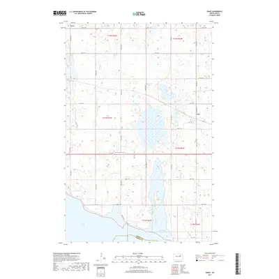
2017 Map of Crary
USGS Topo · Published 2017About this map
Crary serves as the primary hub in this portion of Ramsey County, situated along the railroad corridor and defined by a grid of streets including Main St and Lyle St. The landscape is a complex network of wetland depressions and prairie potholes characteristic of the region, leading down to the expansive waters of Devils Lake and East Devils Lake in the southern sections. This 2017 survey reflects the significant expansion of these water bodies over several decades, which has dramatically altered the surrounding agricultural landscape and road network. To the north, the small settlement of Essex is located at the intersection of 49th St NE and 87th Ave NE. Local history is anchored by the Crary Cem east of town, providing a fixed point of reference amidst the shifting shorelines of the neighboring lake system.
Find a feature on this map
30 named features on this map. Tap any name to fly to it.
Don’t see what you’re looking for? This feature index may not catch every label — zoom into the map to look around manually.
Map Details
Editions of this 2017 Crary Map
This is the sole edition of this map. No revisions or reprints were ever made.
Other maps of this area

1928 · Tokio
USGS Topo · 1:62,500

1930 · Hamar
USGS Topo · 1:62,500

1931 · Tokio
USGS Topo · 1:62,500

1931 · Devils Lake
USGS Topo · 1:62,500

1950 · Tokio
USGS Topo · 1:24,000

1950 · Devils Lake
USGS Topo · 1:62,500

1950 · Devils Lake Mountain
USGS Topo · 1:24,000

1951 · Crary
USGS Topo · 1:24,000

1951 · Devils Lake Mountain
USGS Topo · 1:24,000

1951 · Devils Lake
USGS Topo · 1:24,000