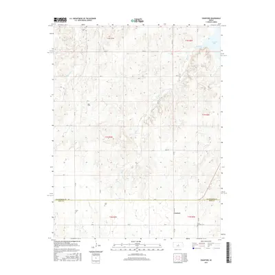
2015 Map of Crawford
USGS Topo · Published 2015About this map
Crawford sits near the southern boundary of this survey, marking a centered point of interest in Rice County as the terrain transitions toward the neighboring Ellsworth County line. The landscape is defined by the dendritic patterns of Bluff Creek and Horse Cr, while the northeastern corner of the map reveals the southern reaches of Kanopolis Lake. A notable density of local family and community history is preserved in the placement of several small cemeteries, including Scates Cem, Forest Grove Cem, Liscum Cem, and Click Cem. These sites, along with landmarks like Rush Field, are connected by a rigid grid of local roads such as Co Rd 107 and Ave S, illustrating the enduring township and range surveying system that shaped this agricultural region. The map provides a clear view of rural settlement patterns just before the mid-2010s.
Find a feature on this map
34 named features on this map. Tap any name to fly to it.
Don’t see what you’re looking for? This feature index may not catch every label — zoom into the map to look around manually.
Map Details
Editions of this 2015 Crawford Map
This is the sole edition of this map. No revisions or reprints were ever made.
Other maps of this area

1891 · Hutchinson
USGS Topo · 1:125,000

1892 · Salina
USGS Topo · 1:125,000

1893 · Hutchinson
USGS Topo · 1:125,000

1894 · Ellsworth
USGS Topo · 1:125,000

1894 · Lyons
USGS Topo · 1:125,000

1942 · Salina
USGS Topo · 1:125,000

1955 · Great Bend
USGS Topo · 1:250,000

1955 · Hutchinson
USGS Topo · 1:250,000

1957 · Great Bend
USGS Topo · 1:250,000

1957 · Ellsworth
USGS Topo · 1:24,000