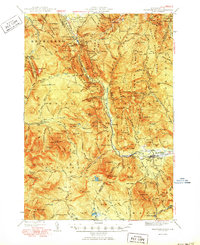
1950 Map of Crawford Notch
USGS Topo · Published 1950About this map
Crawford House and the narrow passage of Crawford Notch dominate this mid-century topographic survey, showing the White Mountains before modern highway expansions. The landscape is defined by the steep descents of the Rosebrook Mountains and the Sargent Ridge, where the Maine Central railroad tracks cling to the mountain flanks alongside the Saco River. This era of White Mountain recreation is well-documented through numerous backcountry landmarks, including the Zealand Falls Hut, Mizpah Spr Shelter, and the Resolution Shelter.
Find a feature on this map
170 named features on this map. Tap any name to fly to it.
Don’t see what you’re looking for? This feature index may not catch every label — zoom into the map to look around manually.
Map Details
Editions of this 1950 Crawford Notch Map
3 editions found
Other maps of this area

1893 · Mt. Washington
USGS Topo · 1:62,500

1893 · Gorham
USGS Topo · 1:62,500

1894 · North Conway
USGS Topo · 1:62,500

1895 · Crawford Notch
USGS Topo · 1:62,500

1896 · Mt. Washington
USGS Topo · 1:62,500

1896 · Crawford Notch
USGS Topo · 1:62,500

1896 · North Conway
USGS Topo · 1:62,500

1896 · Gorham
USGS Topo · 1:62,500

1900 · Whitefield
USGS Topo · 1:62,500

1928 · Plymouth
USGS Topo · 1:62,500