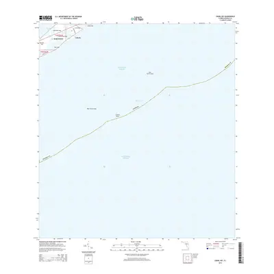
2015 Map of Crawl Key
USGS Topo · Published 2015About this map
Marathon and the surrounding islands of the middle Florida Keys are depicted here at the intersection of Florida Bay and the Atlantic Ocean. The map centers on a series of connected landmasses including Crawl Key, Little Crawl Key, and the western edge of Grassy Key, where the residential and resort settlement of Valhalla is located. The landscape is defined by its maritime geography, with the shallow waters of the Hawk Channel separating the primary islands from offshore features like West Turtle Shoal, East Turtle Shoal, and Coffins Patch. Infrastructure is concentrated along the narrow corridors of the keys, notably following Banana Blvd and Coco Plum DR. This survey captures the fragile balance of a low-lying archipelago where land is nearly outnumbered by water, documenting the precise relationship between the settled keys and the submerged hazards and shoals that navigate the Atlantic side of the Monroe County coastline.
Find a feature on this map
20 named features on this map. Tap any name to fly to it.
Don’t see what you’re looking for? This feature index may not catch every label — zoom into the map to look around manually.
Map Details
Editions of this 2015 Crawl Key Map
This is the sole edition of this map. No revisions or reprints were ever made.
Other maps of this area

1971 · Grassy Key
USGS Topo · 1:24,000

1971 · Marathon
USGS Topo · 1:24,000

1971 · Long Key
USGS Topo · 1:24,000

1971 · Crawl Key
USGS Topo · 1:24,000

1972 · Marathon
USGS Topo · 1:24,000

1972 · Bamboo Key
USGS Topo · 1:24,000

1983 · Islamorada
USGS Topo · 1:100,000

1983 · Key West
USGS Topo · 1:100,000

1989 · Key West
USGS Topo · 1:250,000
2012 · Grassy Key
USGS Topo · 1:24,000