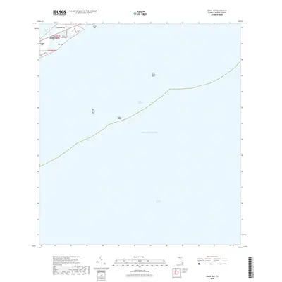
2018 Map of Crawl Key
USGS Topo · Published 2018About this map
Crawl Key and its neighboring islands form a vital link in the Florida Keys chain, situated along the Overseas Hwy as it passes through the community of Marathon. This portion of the Middle Keys shows a landscape defined by narrow landmasses like Grassy Key and Little Crawl Key, which separate the shallow waters of Florida Bay from the deeper Hawk Channel. The map reveals the intricate shoreline of Long Point Key and Fat Deer Key, where residential developments like those along Banana Blvd and Coca Plum Dr meet the marine environment.
Find a feature on this map
19 named features on this map. Tap any name to fly to it.
Don’t see what you’re looking for? This feature index may not catch every label — zoom into the map to look around manually.
Map Details
Editions of this 2018 Crawl Key Map
This is the sole edition of this map. No revisions or reprints were ever made.
Other maps of this area

1971 · Grassy Key
USGS Topo · 1:24,000

1971 · Marathon
USGS Topo · 1:24,000

1971 · Long Key
USGS Topo · 1:24,000

1971 · Crawl Key
USGS Topo · 1:24,000

1972 · Marathon
USGS Topo · 1:24,000

1972 · Bamboo Key
USGS Topo · 1:24,000

1983 · Islamorada
USGS Topo · 1:100,000

1983 · Key West
USGS Topo · 1:100,000

1989 · Key West
USGS Topo · 1:250,000
2012 · Grassy Key
USGS Topo · 1:24,000