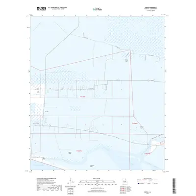
2018 Map of Creole
USGS Topo · Published 2018About this map
Low-lying chenier plains and marshlands define this coastal portion of Cameron Parish, where life and transit follow the subtle elevations of the ridges. The settlement of Creole sits at the junction of local roads and the Creole Canal, while further south, Oak Grove marks the transition toward the Gulf of Mexico. These ridges, including Little Chenier Ridge, Pumpkin Ridge, and Oak Grove Ridge, provide the only dry ground for habitation and agriculture amidst a complex network of wetlands and tidal waters.
Find a feature on this map
32 named features on this map. Tap any name to fly to it.
Don’t see what you’re looking for? This feature index may not catch every label — zoom into the map to look around manually.
Map Details
Editions of this 2018 Creole Map
This is the sole edition of this map. No revisions or reprints were ever made.
Other maps of this area

1934 · Lake Misere
USGS Topo · 1:24,000

1934 · Sweet Lake
USGS Topo · 1:24,000

1934 · Grand Bayou
USGS Topo · 1:24,000

1934 · Boudreaux Lake
USGS Topo · 1:24,000

1935 · Sweet Lake
USGS Topo · 1:31,680

1935 · Lake Misere
USGS Topo · 1:31,680

1935 · Boudreaux Lake
USGS Topo · 1:31,680

1935 · Grand Bayou
USGS Topo · 1:31,680

1935 · Bay Labauve
USGS Topo · 1:31,680

1935 · Grand Chenier
USGS Topo · 1:31,680